
Date: Wednesday, July 29th
Time: 8:00 am MDT
Presenters: Richard Hassler, Joe Blecha, Jeff Ryan, Rui Wu, Steven Witte
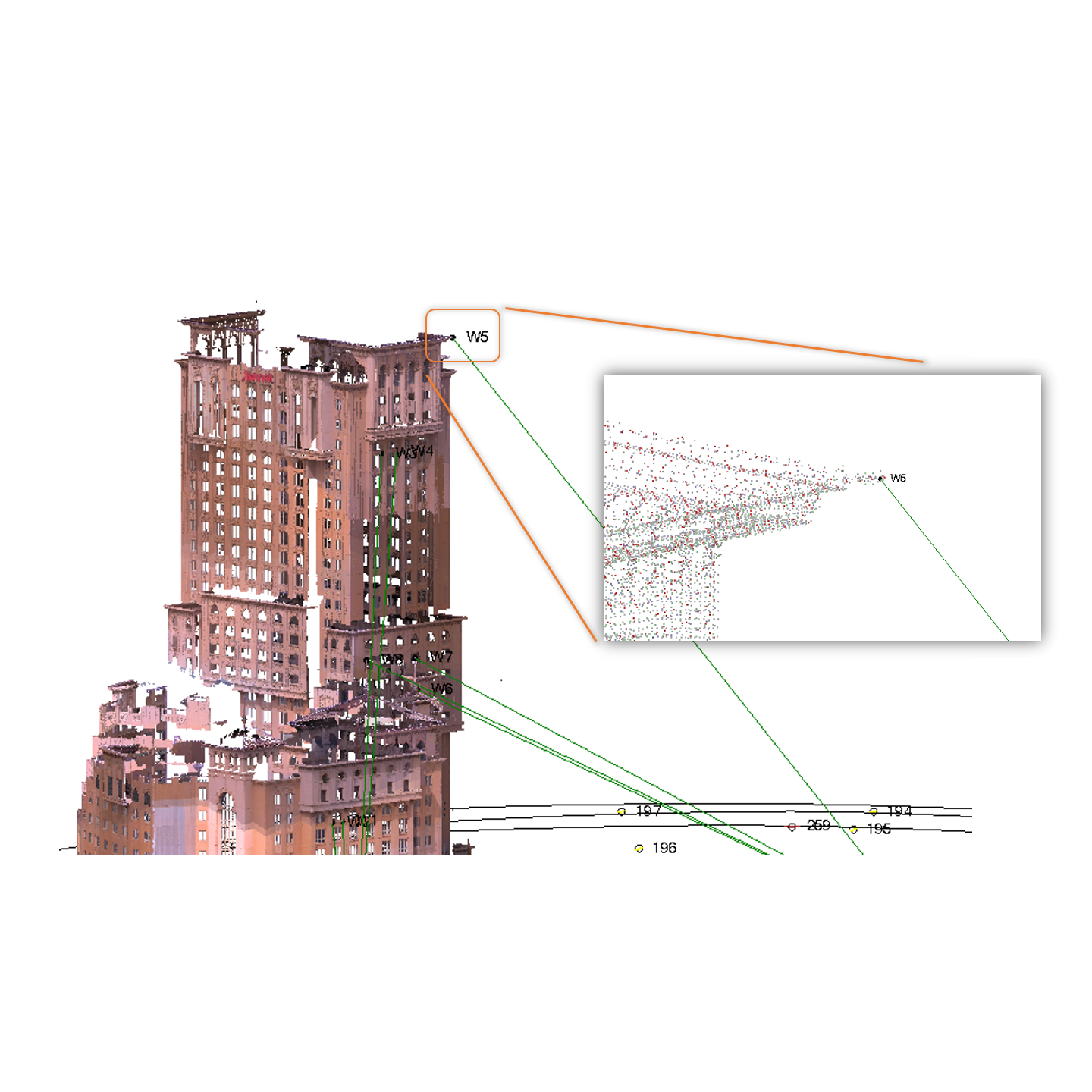
It’s the best of times thanks to all sorts of instruments we have for surveying and construction. It is the worst of times because we need a solution to align all the data together. In this TBC Power Hour, Richard Hassler and Joe Blecha will show you how TBC integrates scanning data and conventional surveying data, delivering consistent results. If you ever wondered why your point cloud doesn’t match with the ground control points, why it’s meters off from the supposed position, or how to transfer data in between different scanning software packages, join us and find answers in the session.
Attendees will learn:
- The root cause of the misalignment between scanning data and surveying data - Scale Factors
- The unique TBC solution of solving the misalignment
- How to properly georeference a terrestrial scan data into the correct projection
- How to integrate UAS data with an SX10 project
- The export configurations to transfer the point cloud to other application packages
I understand that by submitting my personal information to Trimble it is subject to the Trimble Privacy Notice. I agree that Trimble, its authorized representatives and its group of companies can contact me by email to promote their products and services. I consent to receive digital communications from Trimble. I understand I can opt-out of digital communications with Trimble at any time using the unsubscribe link in Trimble's email communications.